Map - Denpasar

Denpasar
Denpasar (Balinese: ᬤᬾᬦ᭄ᬧᬲᬃ) is the capital of Bali and the main gateway to the island. The city is also a hub for other cities in the Lesser Sunda Islands.

With the rapid growth of the tourism industry in Bali, Denpasar has encouraged and promoted business activities and ventures, contributing to it having the highest growth rate in Bali Province. The population of Denpasar was 725,314 at the 2020 Census, down from 788,445 at the 2010 Census due to pandemic outflow, despite having hit 879,098 in 2015, while the metropolitan area centred on Denpasar (called Sarbagita) had 2,388,680 residents in 2020. Pandemic and travel related closures has further exacerbated the population loss, with mid 2022 estimate of 653,136 people.

The name Denpasar – from the Balinese words "den", meaning north, and "pasar", meaning market – indicates the city's origins as a market-town, on the site of what is now Kumbasari Market (formerly "Peken Payuk"), in the northern part of the modern city.

 
Map - Denpasar
Map
Google Earth - Map - Denpasar
Google Earth
Openstreetmap - Map - Denpasar
Openstreetmap
Bali-Denpasar-Map.pn...
3418x3012
www.appartement-bali...
Bali-Denpasar-Map.pn...
3418x3012
upload.wikimedia.org
denpasar-map-0.jpg
2252x3055
www.orangesmile.com
singaraja.png
1692x2382
www.indonesia-touris...
bali-map-high.png
2301x1585
republik-indonesia.c...
tabanan.png
2334x1380
www.indonesia-touris...
bangli.png
1360x2160
www.indonesia-touris...
semarapura.png
1369x2136
www.indonesia-touris...
denpasar%2Bkota.jpg
1600x1369
3.bp.blogspot.com
denpasar%2Bkota.jpg
1600x1369
3.bp.blogspot.com
denpasar%252Bkota.jp...
1600x1369
3.bp.blogspot.com
denpasar+kota.jpg
1600x1369
3.bp.blogspot.com
peta-denpasar.gif
1334x1339
e-kuta.com
denpasar-map-big.jpg
1285x1339
balileisurems.com
Map-Denpasar_1.jpg
950x1200
bali-puteshestvie.ru
map-bali.gif
790x1200
www.balileisurems.co...
Denpasar.png
1088x800
www.balitourismboard...
Denpasar_map.jpg
1044x706
upload.wikimedia.org
balimap.jpg
618x1000
4.bp.blogspot.com
denpasar-map.jpg
700x844
www.planetware.com
Country - Indonesia
Flag of Indonesia
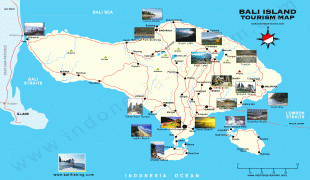
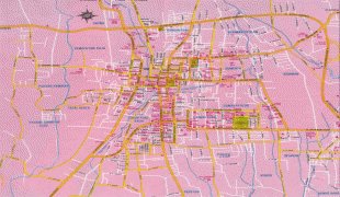
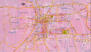
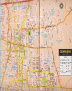
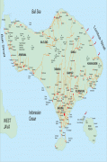
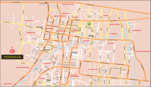
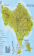
Indonesia, officially the Republic of Indonesia, is a country in Southeast Asia and Oceania between the Indian and Pacific oceans. It consists of over 17,000 islands, including Sumatra, Java, Sulawesi, and parts of Borneo and New Guinea. Indonesia is the world's largest archipelagic state and the 14th-largest country by area, at 1,904,569 km2. With around 280 million people, Indonesia is the world's fourth-most populous country and the most populous Muslim-majority country. Java, the world's most populous island, is home to more than half of the country's population.

As the world's third largest democracy, Indonesia is a presidential republic with an elected legislature. It has 38 provinces, of which nine have special status. The country's capital, Jakarta, is the world's second-most populous urban area. Indonesia shares land borders with Papua New Guinea, East Timor, and the eastern part of Malaysia, as well as maritime borders with Singapore, Vietnam, Thailand, the Philippines, Australia, Palau, and India. Despite its large population and densely populated regions, Indonesia has vast areas of wilderness that support one of the world's highest level of biodiversity.
Currency / Language  
ISO Currency Symbol Significant figures
IDR Indonesian rupiah Rp 2
Neighbourhood - Country  
  •  Malaysia 
  •  East Timor 
  •  Papua New Guinea